

🧭 Vietnam Travel Maps – Quick Overview
- ✔ Explore Vietnam travel maps with major destinations, cities, and routes across the country
- ✔ Use interactive Google Maps to plan distances, routes, and travel time
- ✔ Find railway, bus, and airport maps for easier transportation planning
- ✔ Discover regions of Vietnam – Northern, Central, and Southern areas
- ✔ Helpful for building your itinerary and navigating both cities and remote areas
Last updated in May 2026
Vietnam Travel Maps for Navigation and Trip Planning
Vietnam travel map showing major destinations, cities, routes, and transport connections across the country. Explore Northern, Central, and Southern Vietnam using detailed maps for trip planning and navigation. These maps help you find the best places to visit, plan routes, and estimate travel distances easily.
Explore maps of Northern, Central, and Southern Vietnam, including airports, railway routes, and key transport connections. Many travelers rely on Google Maps with GPS for real-time navigation, especially in cities and popular tourist areas.
However, in remote or mountainous regions, mobile internet coverage may be limited, and some apps may not work reliably. In these cases, it’s recommended to download offline maps or use a backup map. Asking locals for directions can also help, although not everyone uses maps regularly.
⚠️ Within the 18 Most Fascinating Places in Northern Vietnam section, you’ll find detailed Google Maps with photos and useful travel information to help you navigate and avoid getting lost.

⬆️ Northern Vietnam Map: Best Places to Visit & Travel Highlights:
This map of Northern Vietnam shows the main travel destinations including Sapa, Ha Giang Loop, Ha Long Bay, and Cao Bang. Use it to plan your route, distances, and key stops.

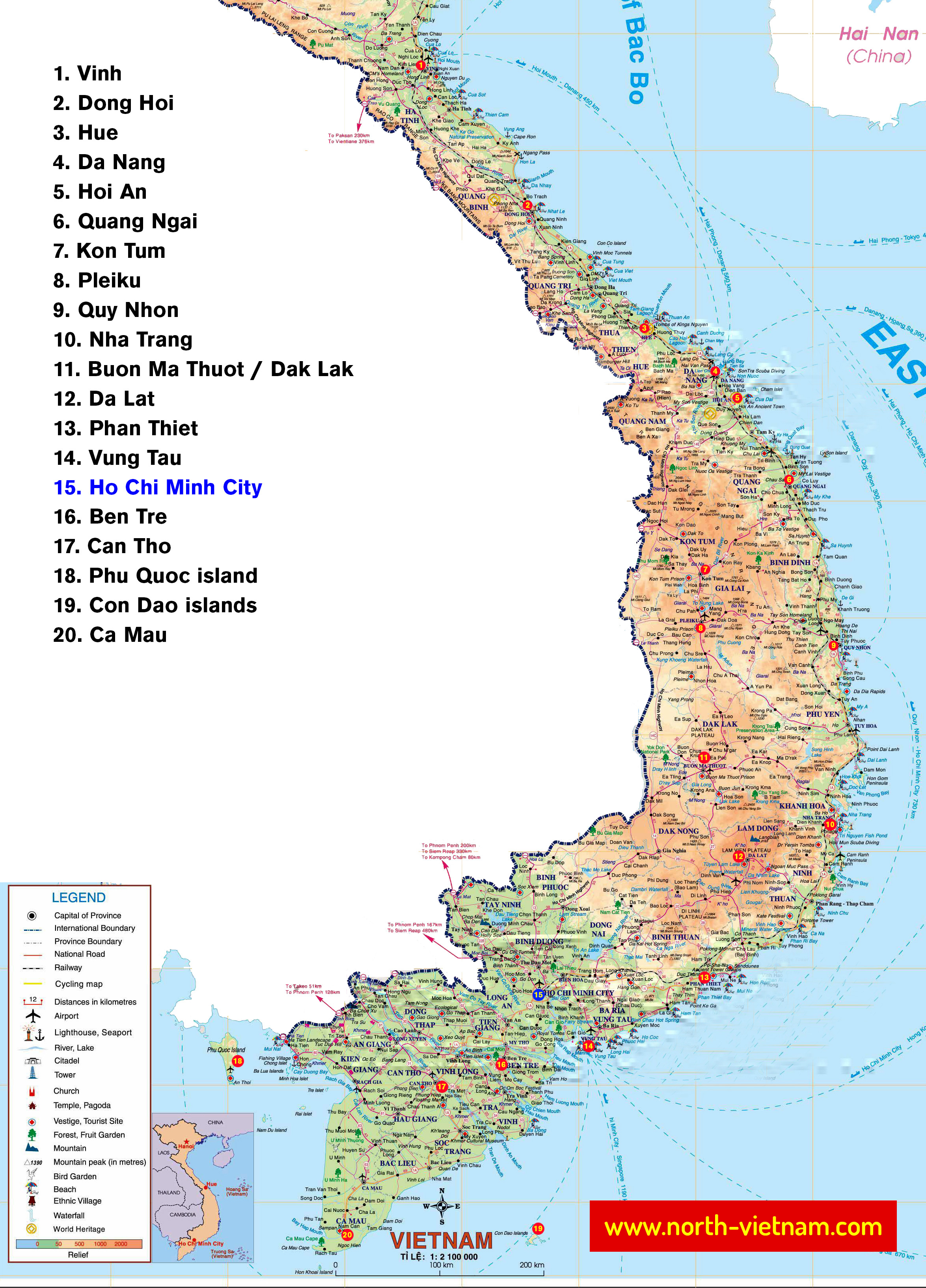
⬇️ Central + Southern Vietnam Map: Best Places to Visit & Travel Highlights:
This map of Central and Southern Vietnam features the best places to visit, from cultural cities to tropical islands and national parks. Use it to plan your itinerary, travel routes, and key stops.
📍 Google Maps of Vietnam:
- Do not rely only on the mobile version of Google Maps, especially in remote areas.
- Mobile internet may not work reliably outside major cities and tourist destinations.
- Download offline maps in advance to avoid navigation issues. > How to download offline maps (for example, Hanoi and surrounding areas can require around 250 MB of storage)
- Some smaller roads, rural routes, and paths may not appear on the map.
- Road conditions can vary, and some routes may be difficult or poorly maintained.
- Google Maps is not always fully up to date, as infrastructure in Vietnam is rapidly changing.
- Despite these limitations, Google Maps works well for most travel situations in Vietnam.
🏢 The most important cities in map of northern Vietnam:
This Google Map of Northern Vietnam highlights the best places to visit, major cities, and key travel routes, including popular stopovers and attractions across the region.
⬇️ Central and Southern Vietnam Map: Best Places to Visit and Major Cities:
Many travelers also continue to Central Vietnam and Southern Vietnam. Although this site mainly focuses on Northern Vietnam, this map highlights major cities and possible travel stops across Central and Southern Vietnam.
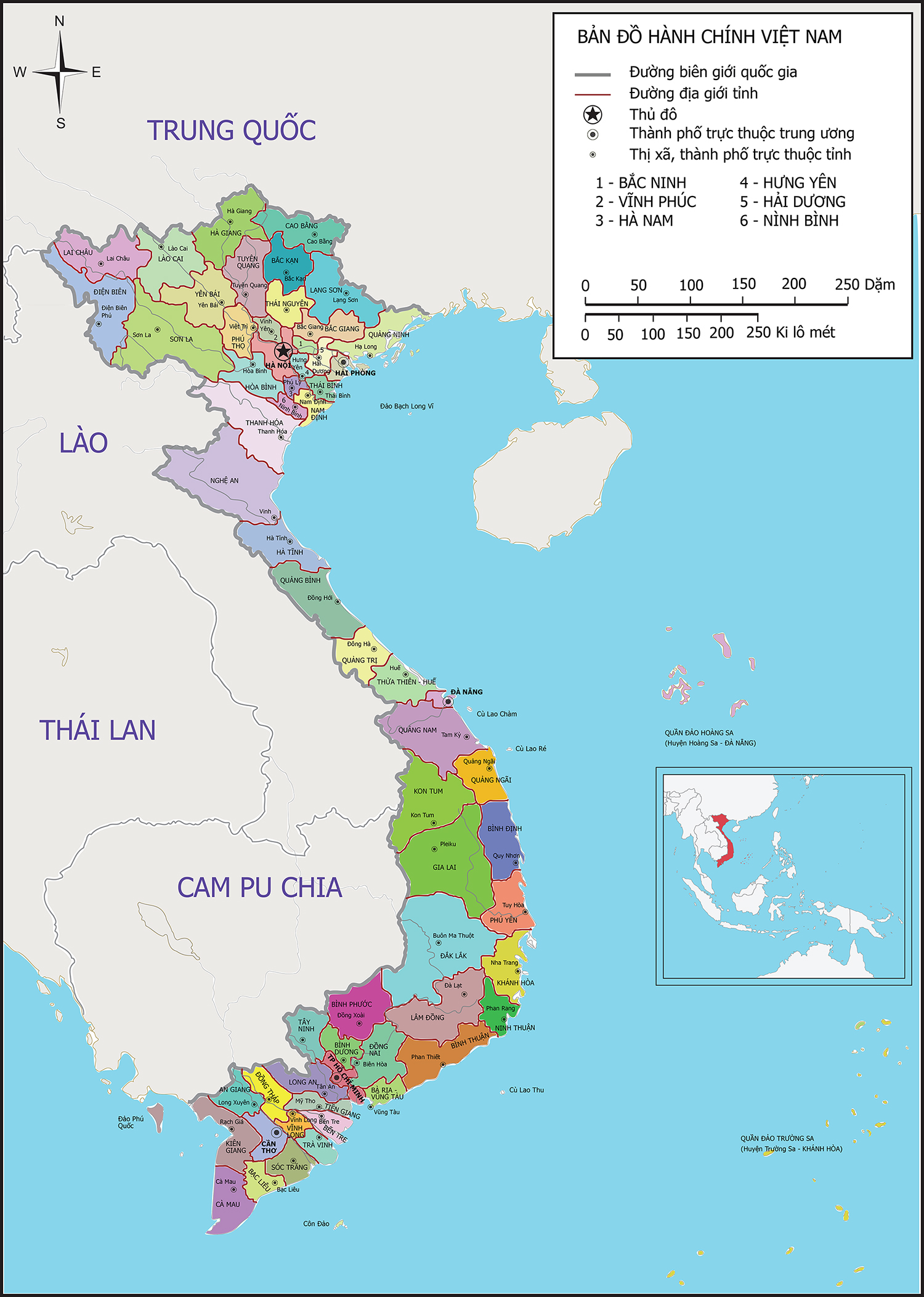
🗾 Vietnam Provinces and Regions Map:
Map of the provinces in Vietnam. This map of Vietnam displays all provinces and regions, providing a clear overview of the country’s administrative divisions.
🚉 Vietnam Railway Map: Routes, Stations and Main Train Lines
Vietnam Railway Map: Overview of the main train routes and railway stations across the country. Click on the image below or visit Railway Map of Vietnam.
Planning to travel by train, bus, or ferry in Vietnam? Read my guide on how to book tickets in Vietnam and explore available routes.

✈️ Vietnam Airport Map: International and Domestic Airports:
Color legend: Red = domestic airports, Blue = international airports, Green = future airports. See the full list of airports in Vietnam for more details. Interactive map of Vietnam airports with international and domestic flights, including major airport locations and planned future airports.
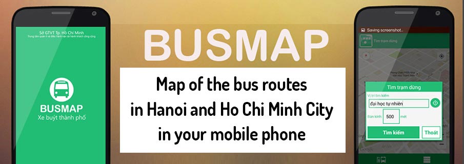
🚍 BusMap – Map of bus lines in Hanoi, Ho Chi Minh City, Da Nang:
The BusMap app is a free mobile application for navigating public buses in Vietnam. It is available for both Android and iOS and covers major cities such as Hanoi, Da Nang, Can Tho, and Ho Chi Minh City, as well as nearby provinces.
The app provides a clear map of bus routes, stops, and line numbers, along with basic navigation. It works online and also offers a limited offline mode without GPS tracking.
Download BusMap: Android | iOS
🚍 Hanoi Bus Map: Public Transport Routes and Stops:
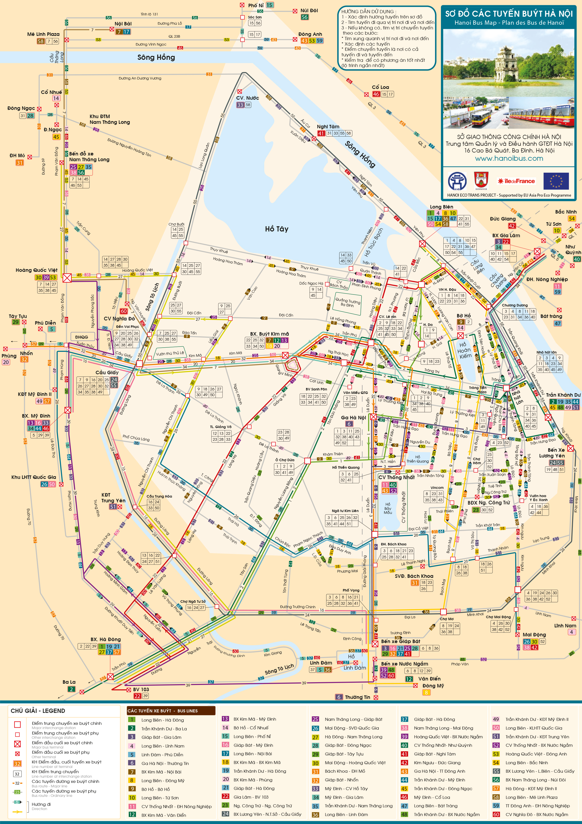
Hanoi has an extensive public bus network covering most parts of the city, with routes connecting major districts and key locations. Tickets are usually sold on board by a conductor, and payment is made in cash, so it’s best to carry small bills.
While buses are affordable, the system can be confusing for first-time visitors and less comfortable during heavy traffic. Click on the image below to view the high-resolution Hanoi bus map (2026).
For easier navigation, I recommend using the BusMap mobile app, which is up to date and simple to use. More information is provided below.
📍 More Vietnam Maps and Travel Resources
-
➡️ Vietnam Travel Itinerary Maps
Explore suggested travel routes and itineraries across Vietnam, including popular travel plans and multi-day routes. -
➡️ National Parks and Trekking Maps in Vietnam
Discover maps of national parks, trekking areas, and outdoor destinations ideal for hiking and nature travel. -
➡️ Vietnam Border Crossings Map
Find all official border crossings in Vietnam, including entry and exit points with a 90-day e-visa.
The most frequented travel routes in the north of Vietnam:
– these travel routes are the most frequented and popular, read how to travel to these places in Vietnam










❓ FAQ + Tips – Maps, Transport and Travel in Vietnam:
What is the best time to visit Northern Vietnam?
The best time to visit Northern Vietnam is usually from September to November and from March to May.
What are the best places to visit in Northern Vietnam?
Popular destinations include mountains, national parks and cultural sites. See this guide: 18 Most Interesting Places in the North.
What is the main airport in Northern Vietnam?
The main airport is Noi Bai International Airport, about 25 km from Hanoi city center.
How extensive is the railway network in Vietnam?
Vietnam’s railway network mainly connects the north and south of the country. See the Vietnam Railway Map.
What are the main transportation options in Vietnam?
You can travel by train, tourist bus, sleeper bus, minivan, taxi, ferry or domestic flight. Read more about transportation in Vietnam.
Can you travel by train from Vietnam to China?
Yes, you can travel by train from Hanoi to Nanning via the Dong Dang border crossing.
How to book tours and activities in Vietnam?
You can search and book tours, activities and attraction tickets online via KLOOK.
Where are the main border crossings in Vietnam?
Vietnam has border crossings with Laos, Cambodia and China. See the border crossings map.
Where can you travel from Vietnam?
From Vietnam you can travel to Laos, Cambodia or China by train, tourist bus, minivan or international flight.