

ℹ️ Information – Tham Ma Pass
🚶 How to get to Tham Ma Pass
🔍 What to see in Tham Ma Pass
❓ FAQ + Tips for Tham Ma Pass
📸 Photos of Tham Ma Pass
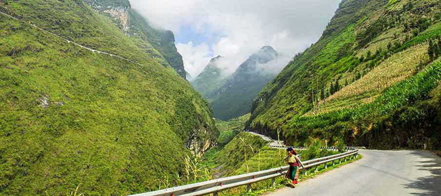
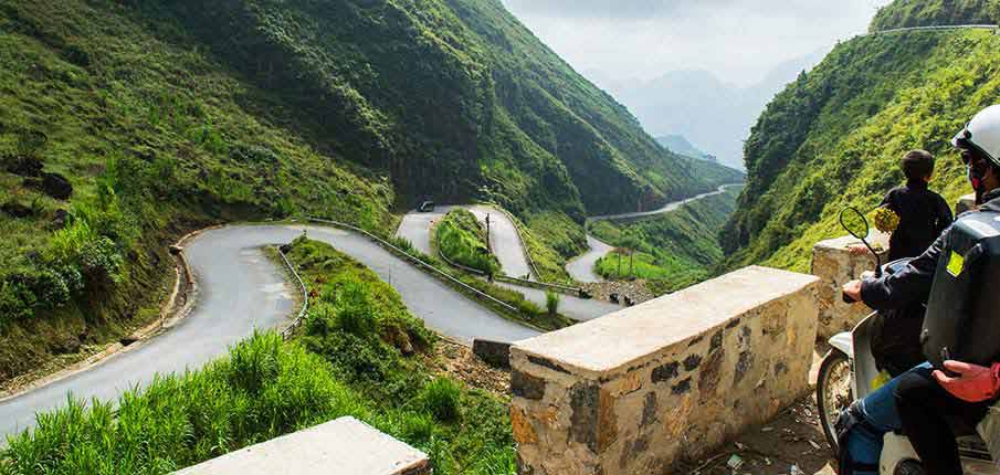
Quick answer: Tham Ma Pass (also called Độc Thẩm Mã) is a steep, winding S‑shaped mountain road in Ha Giang, part of the Dong Van Karst Plateau. It’s famous for its dramatic curves, rugged cliffs and viewpoints, and is a highlight on motorcycle tours of the Ha Giang Loop.
At a glance:
- 📍 Location: Between Lung Thau and Van Chai villages, Dong Van District, Ha Giang.
- ⛰️ Length & elevation: About 5 km long, at roughly 1,500 m altitude.
- 🛣️ Road style: Sharp zigzag/S-shaped curves, very steep in places.
- 👥 Who lives here: Hmong ethnic minority, living in rocky terrain and growing crops on sparse soil.
- 📷 Viewpoint: A lookout at the top offers great views of the winding road below.
- ⚠️ Difficulties: Steep grades, tight turns, and possible bad weather — ride carefully or go with a guide./li>
- 📅 Best time to visit: Autumn and spring are ideal; avoid heavy rain or fog.
Last updated in November 2025
Tham Ma Pass – one of many beautiful mountain passes in Ha Giang province.
-
- Tham Ma Pass (Greatly steep Code, Dốc Thẩm Mã or Tham Ma slope) is a mountain pass/road in Ha Giang province (Dong Van District, Lung Thau). Dong Van District and its Dong Van Karst Plateau Geopark offers a number of great mountain passes and paths and this is one of them. If you drive from Ha Giang town to Dong Van north along QL4C you can not miss it because it is a part of this road.
-
- The nearest bigger town is Yen Minh, Tham Ma Pass is about 10 km from this city and approximately 5 km lenght, between Pho Cao and Van Chai villages. Yen Minh is a bigger town in Ha Giang province, offering shops, restaurants and other services, you can make a short stopover in this place.

How to get to the Tham Ma Pass? The best way is to travel by motorbike/mototaxi.
-
- Probably you will be traveling from Ha Giang to Dong Van on QL4C National highway in the north of Vietnam. So, first you have to travel to Yen Minh town, it is about 70 km from Ha Giang. From Ha Giang to Dong Van you can travel by local bus, but the best way is to travel by motorbike or you can use mototaxi in Yen Minh town.
-
- Some road sections in Ha Giang province are dangerous, drive carefully and slowly, it is a mountain area. Traveling by motorbike is the best way for the experienced drivers. From Tham Ma Pass you can continue to Dong Van town, only about 30 km.
Book bus tickets to Ha Giang ➜
1. Travel by motorbike on your own (experienced drivers)
2. Motorbike taxi in Yen Minh town
3. Local bus from Ha Giang to Dong Van
4. Motorbike tour with guide
In Yen Minh district you can see beautiful mountain sceneries + ethnic villages.
-
- All around the city of Yen Minh is beautiful, it is already Dong Van Karst Global Geopark area, so you will see especially fascinating mountain areas, nature, ethnic villages and ethnicity. This area has no “tourist attractions” and still retains its authenticity. For those who will have more time or stay in Yen Minh and travel on a motorbike, they can also explore the surroundings, several other side-trips to remote areas and, above all, to minority villages and nature.


What is the best time to visit the Tham Ma Pass? And what about the weather?
-
- You can visit the Tham Ma Pass all year round. However, this is true for other mountain sites in Ha Giang Province, if you can avoid a lot of rainy days, rainy days are mainly in the monsoon season, in the summer months. In the winter (December – February) it may be very cold in the area and it is also good to have some warm clothes. A suitable time to visit Tham Ma Pass in Dong Van Karst Plateau Geopark can be the autumn months. Spring is also not bad, read carefully this article: Weather in Ha Giang.

❓ Tham Ma Pass: FAQ & Travel Tips
Where is Tham Ma Pass?
Tham Ma Pass is about 10 km from Yen Minh and 30 km from Dong Van in Ha Giang Province. It is part of the UNESCO-listed Dong Van Karst Plateau Global Geopark.
How do you get to Tham Ma Pass?
Travel from Ha Giang to Yen Minh or Dong Van by local bus, motorbike, Easy Rider or private car. Tham Ma Pass lies directly on the Ha Giang Loop.
Is Tham Ma Pass dangerous?
The road is steep with sharp bends, so drive carefully, especially during rain or fog.
How long is Tham Ma Pass?
The mountain pass is approximately 5 km long.
What should you prepare for the visit?
Wear warm clothing during winter and avoid riding in heavy rain or dense fog when visibility is poor.
When is the best time to visit Ha Giang?
The best months are September to November and March to April. See our guide to Ha Giang weather for seasonal tips.
What attractions are near Tham Ma Pass?
Continue to Dong Van, Ma Pi Leng Pass, Lung Cu Flag Tower, Hmong King’s Palace and traditional ethnic minority villages.
Do you need a permit for Ha Giang?
Some border areas require a Ha Giang permit, so check the latest regulations before your trip.
What are the best things to do in Ha Giang?
Popular activities include the Ha Giang Loop, mountain trekking, visiting ethnic markets, exploring villages and enjoying spectacular mountain passes.
Is Vietnam a good destination for solo travelers?
Read our guide to solo travel in Vietnam for practical travel tips.
What should first-time visitors expect from Vietnamese culture?
Learn about local traditions and hospitality in our guide to Vietnamese culture.

Tham Ma Pass in Ha Giang (Greetly steep code) – Photos:



Lung Cu Flag Tower|Lung Khuy Cave|Ma Pi Leng Pass|Ban Gioc Waterfalls|Hue to Ninh Binh|Ninh Binh|Nha Trang|Weather in Ha Giang